


Explore These Smoky Mountain Waterfalls Near Bryson City.
A trip to the Smoky Mountains of Bryson City is incomplete without a visit to our gorgeous waterfalls. Wide open spaces, fresh air, and the sights and sounds of water create the perfect opportunity to get back in touch with nature. Some of these waterfalls can be seen from the road while others require a short hike. We have set aside these waterfall loops in 4 different option. See the map at the bottom of this article for specific directions.
Here are the best waterfalls in the Bryson City area:
Deep Creek - A Waterfall Loop on Foot
The Deep Creek section of the Great Smoky Mountains National Park is just a couple miles outside of downtown Bryson City. Here you’ll find 3 stunning waterfalls in a 2.5 mile easy hike:
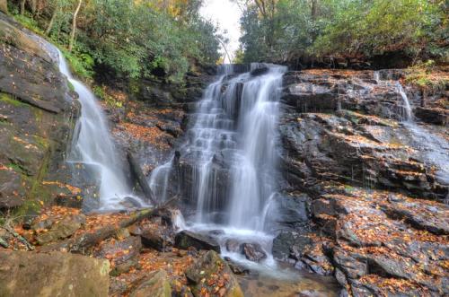
1. Juney Whank Falls
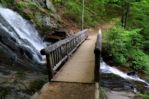
Our waterfall tour begins at the Deep Creek Trailhead parking area. Look for signs at the parking area directing you to a well-marked trail for 1/4 mile to Juney Whank Falls. This is the only trek along the waterfall loop that has a moderate incline. When you reach the falls, walk across a scenic footbridge to observe the falls and the 90-foot cascade that flows underneath it. On one end of the footbridge, look for a large rock that is perfect for a selfie in front of Juneywhank Falls.
Juney Whank is a Cherokee phrase which means “the place where the bear passes.”
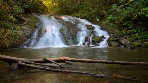
2. Tom Branch Falls
From Junewhank Falls, continue across the footbridge where you can descend the trail on the other side. Once you reach the main Deep Creek Trail, walk to the left continue approximately 1,000 feet along the trail and creek to reach Tom Branch Falls. This gentle waterfall is 60 feet tall and flows into Deep Creek. There are benches for resting and soaking in the beautiful scenery. Or put your feet in the cool waters of Deep Creek. This area of the creek is popular for fishing and tubing, so you’re almost sure to see meandering through the creek.
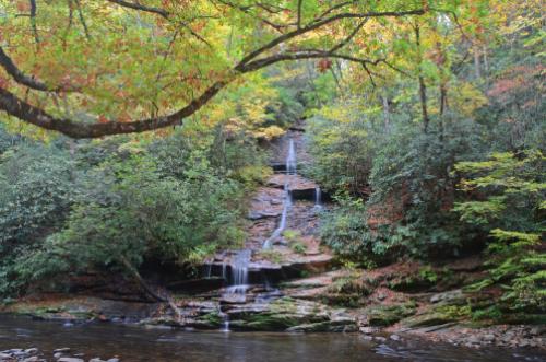
3. Indian Creek Falls
The third of the Deep Creek waterfalls is Indian Creek Falls, which is about 8/10’s of a mile from Tom Branch Falls. Continue over a wide footbridge, where the trail takes a slighter incline. Watch for signs to turn right on the trail to Indian Creek Falls, which is just 1/10 of a mile from the sign. Look for a footpath and steps off to your left to step down and observe Indian Creek Falls from a small platform. The falls are just 25 feet high, but the soothing sounds and the calm pool below are sure to catch your breath.
The next two waterfalls are located near Cherokee, North Carolina.
4. Mingo Falls
Located on the Cherokee Indian Reservation, there are two beautiful waterfalls you’ll want to visit: Mingo Falls and Soco Falls. Mingo Falls can be found in the community of Big Cove. This breathtaking cascade, whose name means “Big Bear” in the Cherokee language, is 120 feet tall. This makes it among the tallest waterfalls in all of Southern Appalachia.
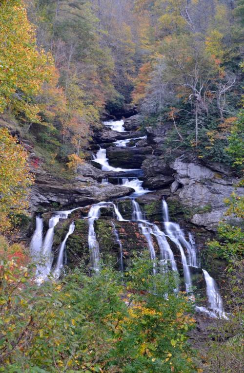
5. Soco Falls
Soco Falls is a popular double waterfall in the Cherokee region. It is located 11 miles east of Cherokee on U.S. 19. This natural wonder is best known for its dual cascades, which can be seen from a safe viewing platform accessed via a small road pull-off that’s less than two miles from the Blue Ridge Parkway. For a closer view, continue down a steep trail to the base of the waterfalls. But beware, that this steep trail is dangerous and not recommended for most people to traverse.
Nantahala Gorge Area
6. Upper Nantahala Cascades
The rocks and rushing water at the Upper Nantahala Cascades create swirling rapids that make it a must-visit spot amongst thrill-seeking kayakers and rafters. For those not wanting to dip their toes into this fast-flowing waterway, much of the Cascades can be safely viewed on foot or from your car after taking a scenic drive up to Wayah Road to reach its start. This is a pet-friendly waterfall!
The Nantahala River is known for whitewater adventures; however, very few people realize that this waterfall exists. To access the cascades, take US 19/74 to the southern end of the Nantahala Gorge. Following Wayah Road, you'll see the Upper Nantahala Cascades further up on your right.
7. Findley Falls
Findley Falls is a series of small waterfalls located on Ledbetter Creek in the Nantahala Gorge. Findley Falls is the last section of Ledbetter Creek before it passes underneath railroad tracks and US19/US74 and empties into the Nantahala River. To find the trailhead, there is no signage, however there is a parking area and picnic tables. Findley Falls is located just upstream of the trailhead (less than 1/4 mile). There is a small parking lot just off of US19/US74 and the trail goes through the area with the picnic tables and across the railroad tracks. There are alternative access points . One is just down the road in a parking lot on National Forest Road (you can then cross the road and take the trail that is just across the road). To get to the falls make sure you keep going straight when the trail forks (don't go over the bridge).
Findley Falls was dedicated by the North Carolina Bartram Trail Society on April 14, 2018, and is named in memory of H. Franklin "Frank" Findley (1953-2017), the District Ranger of the Cheoah District of the Nantahala National Forest. Mr. Findley was instrumental in organizing and coordinating the location of the last section of the Bartram Trail to reach Cheoah Bald.
Highlands Cashiers Waterfalls
The next 5 waterfalls are in the Highlands/Cashiers area:
8. Cullasaja Falls
Cullasaja Falls is a 250-foot cascading waterfall, and is viewable from the road, but there's only a small pull off area suitable for 2-3 vehicles. The safest way to approach is from the Franklin side, west of the falls. From the intersection of Hwy 441 and 64 east, the waterfall is about 7.7 miles east on 64. If you are coming from Highlands, the falls is 5.5 miles past Dry Falls.
9. Dry Falls
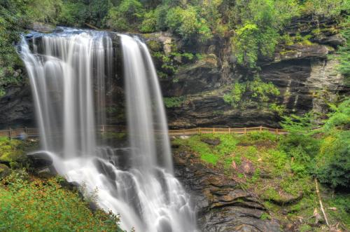
One of the region’s most beautiful waterfalls, Dry Falls is located about 5.5 miles past Cullasaja Falls, also on the right. It is accessible via a short, paved trail with a few series of steps. The trail takes you behind the waterfall, where you’ll likely experience a cool mist, and onto the other side of the falls for an even better view of the falls. Will you get wet when you walk behind Dry Falls? Try it for yourself and see. It’s one of North Carolina’s most beautiful and easy-access waterfalls. There’s a viewing platform next to the parking lot that’s wheelchair and stroller accessible.
10. Bridal Veil Falls
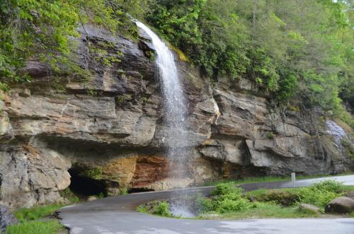
Bridal Veil Falls is just a stone's throw away from Dry Falls and will be located on the left side of the road (you can’t miss it). This 120-foot waterfall cascades over US 64 and is located only a few dozen feet from the highway, 2.5 miles west of Highlands. For a more leisurely view or to take a photograph, there is a pull-off just beyond the falls. Bridal Veil Falls sometimes displays a rainbow in the afternoon light. Just like Dry Falls, it's also possible to walk behind the waterfall for an unforgettable photo-op.
11. Silver Run Falls
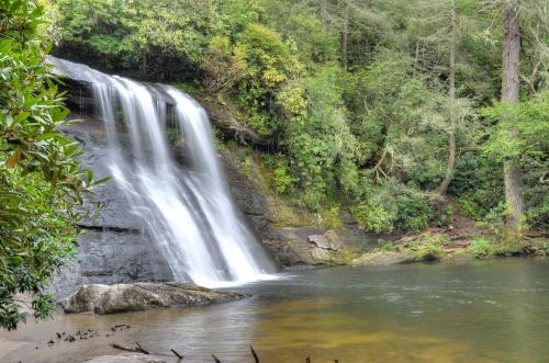
After you leave Bridal Veil Falls, continue east on U.S. 64 to the small town of Highlands, and on to Cashiers, NC. To get to Silver Run Falls, turn right on NC 107 in Cashiers and travel 4.1 miles south to park in the pull-off to the left. Take the .2 mile out and back trail, considered easy. Dogs are welcome but must be on a leash.
Silver Run is just four miles south of Cashiers, North Carolina. This 25-ft. waterfall cascades into a tranquil pool, and it doubles as a swimming hole in the warmer months. Silver Run Falls is very photogenic and easy to photograph from several vantage points.
12. Whitewater Falls
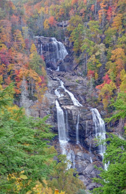
Whitewater Falls is the highest waterfall east of the Rockies. The falls plunge an amazing 411 feet! For the best views of Whitewater Falls, follow the paved walkway to the upper overlook. The walkway begins at the end of the parking lot and is accessible to wheelchairs. A lower overlook is located at the bottom of 154 wooden steps. This area also has picnic tables, restrooms, and there is a $3 fee for vehicles with seven passengers or less.
How to get there from Cashiers: Drive south on NC 107 for 9.3 miles. Shortly after crossing the State line into South Carolina, turn left at the sign for Whitewater Falls. Continue 2.3 miles to the intersection with SC 130, which becomes NC 281 at the North Carolina State line. Just beyond this point is a sign for the entrance to Whitewater Falls.
We hope you enjoy your waterfall tour of Western North Carolina. And while you’re in the Bryson City area, don’t forget to check out these incredible day hikes in the Great Smoky Mountains National Park.